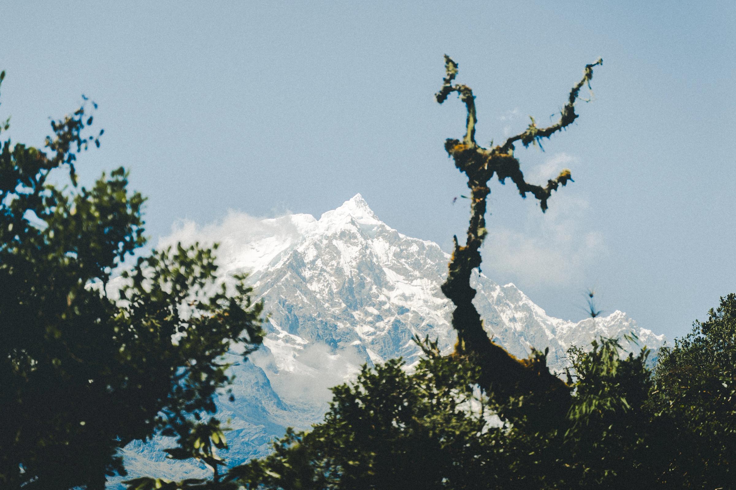
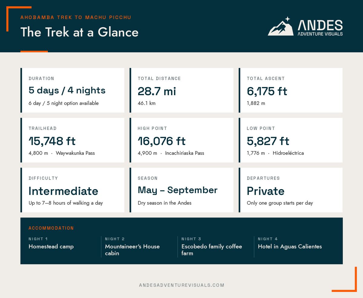
At 4:00am, Cusco's colonial-style streets are calm and quiet. While most of the city is still asleep, we depart from the Inca city en route to the Ahobamba trek to Machu Picchu. Three and a half hours later, we arrive at the Waywakunka trailhead at 15,748 feet (4,800 meters) above sea level, where the trek begins. After walking for about two hours, we will already be standing on Incachiriaska Pass at 16,076 feet (4,900 meters) with outstanding views, close to the southeast ridge of Nevado Salkantay. That is how the Ahobamba trek begins. It ends four days later at Machu Picchu, one of the most iconic places in South America. In between, you walk through a valley that relatively few people visit each year.
The Ahobamba trek is a five-day trekking route that starts below the Apu (sacred mountain) Salkantay, goes up over two high passes, then drops into the Ahobamba valley, descends through bamboo-covered cloud forest, and finally joins the standard trail at Hidroeléctrica for the final walk to Aguas Calientes. The trail is maintained by the families who live in the valley and our staff. On our departures, we guarantee you won't share the Ahobamba valley with another group.
I think it is the best trekking route to Machu Picchu. I know that is a bold statement, and I'm the one selling the trip, so this article gives you everything you need to judge it for yourself: the day-by-day itinerary, walking distances and elevation profile, how difficult it is, what you see and experience, when to go, and what it costs. If you'd rather skip ahead, the full trip details are on our Ahobamba Trek to Machu Picchu page.
Every departure is private, so the departure date is up to you. Only one group is allowed to start the trek per day, which means spaces are limited. Send me your travel window and we can talk about what's possible.
Why Choose the Ahobamba Trek Over Salkantay or the Inca Trail?
Most people who hike to Machu Picchu choose one of two routes: the Classic Inca Trail or the Salkantay trek. Both are popular for good reasons. However, they are also crowded for those same reasons.
A Trail Without the Crowds
The Inca Trail allows 500 departure permits per day, and that number includes guides and porters. It sells out months in advance during the high season, and you share the trail, the campsites, and the Inca Sun Gate with 499 other people who have a permit.
The Salkantay trek has no daily cap. In May, June, July, and August, it's common to see hundreds of trekkers and support staff hiking together from Soraypampa village (below the extremely touristy Humantay Lake day hike) all the way to Hidroeléctrica.
The Ahobamba trek begins in the same mountain range as the Salkantay trek, but it goes around a completely different side of the mountain where no one else goes. Halfway through Day 1, it enters a private valley: the Ahobamba. The only people you'll share a trail with are the other hikers on the train tracks from Hidroeléctrica on Day 4, and by then you'll have had three full days to yourself.
When I'm alone on a trail or with few other people, I'm more in touch with the landscape around me. That is what makes the Ahobamba Trek to Machu Picchu special.
Maintained by Local Families
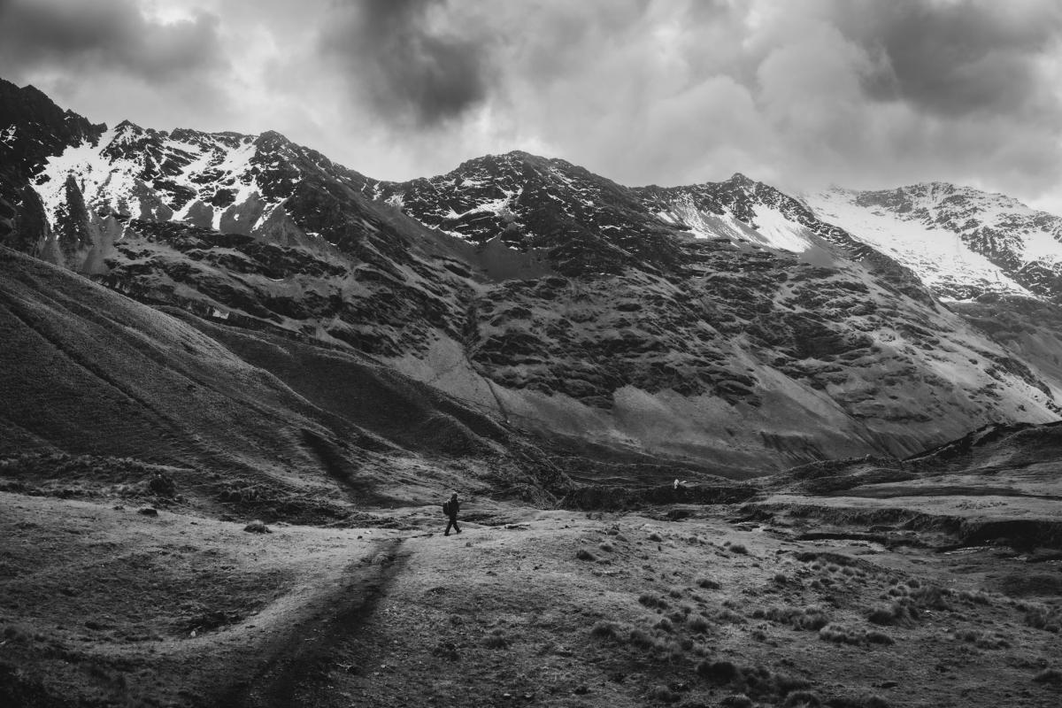
The trail through the Ahobamba valley is maintained by the families who live there, as well as our guides and staff when we pass through. Together, we keep the trail open, clear the dense forest, and maintain the bridges. The families host our trekking groups, including the homestead where we camp on Day 1, the Mountaineer's House on Day 2, and a third-generation coffee farm on Day 3. The entrance fees to the valley go directly to the families, who we also work with directly to operate the trek.
At AAV, we always partner with the communities where we operate. Without these local families, this trek would not be possible.
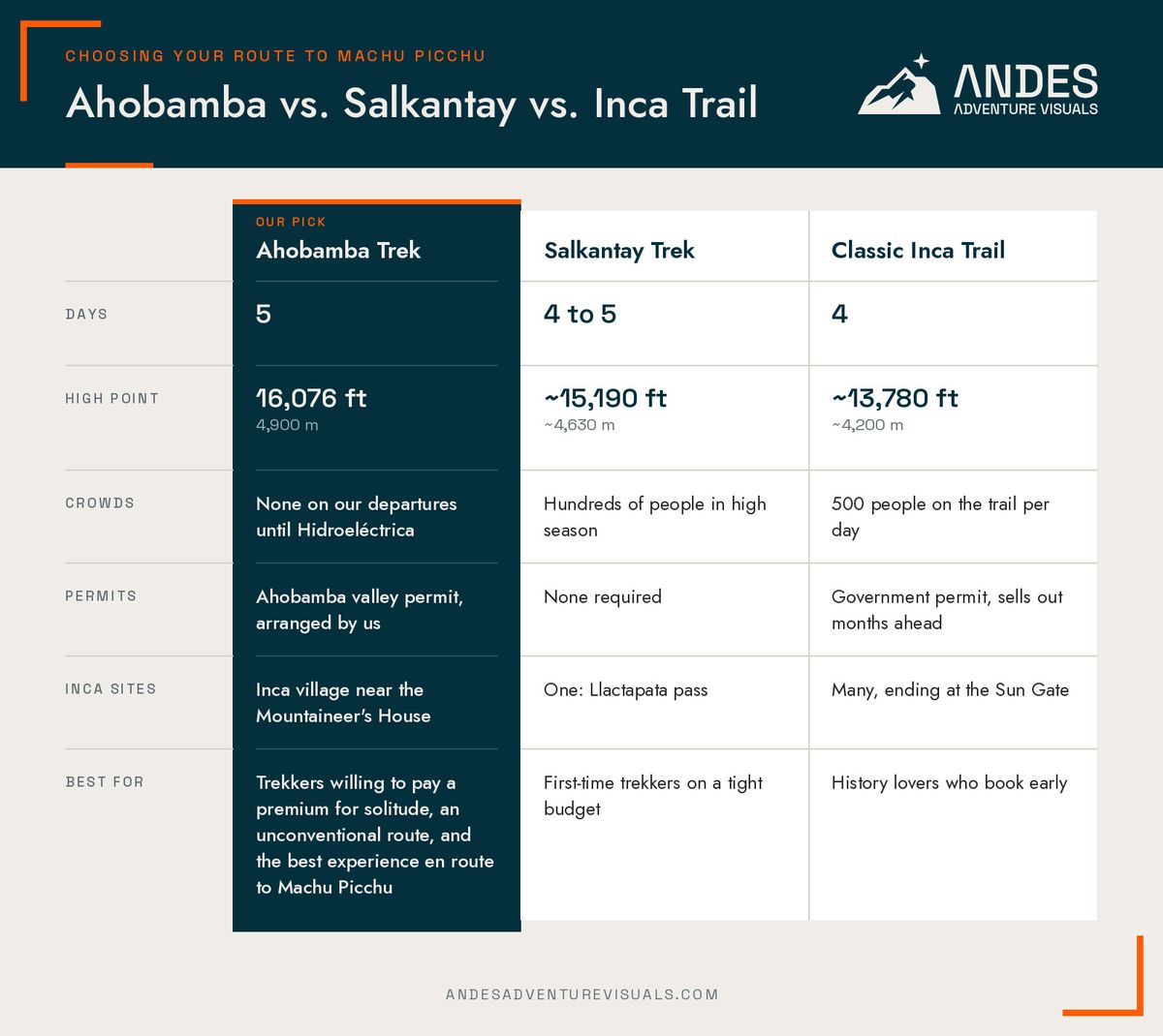
If you want to walk through the Sun Gate and see the most impressive Inca sites on an ancient Inca road, do the Inca Trail. If you're on a tight budget and don't mind company, Salkantay is a great trek. If you want the high mountains, the cloud forest, and the silence of a private trail, choose Ahobamba.
Ahobamba Trek Route Overview and Elevation Profile
The Ahobamba trek is best described as a crescendo. It starts a bit cold, high, and open, with expansive views below Salkantay. Then it narrows day by day into warmer, greener, and denser terrain until you reach the most famous ruins in the Americas.
Where the Trek Starts and Ends
The trek starts at the Waywakunka trailhead in the Cordillera Vilcabamba, a three-and-a-half-hour drive from Cusco. It ends in Aguas Calientes, the town at the foot of Machu Picchu. From there, you take the bus up to the sanctuary on Day 5 and the train back to Cusco in the afternoon. There is no need to backtrack at any point, and every transfer is included from Day 1 to Day 5.
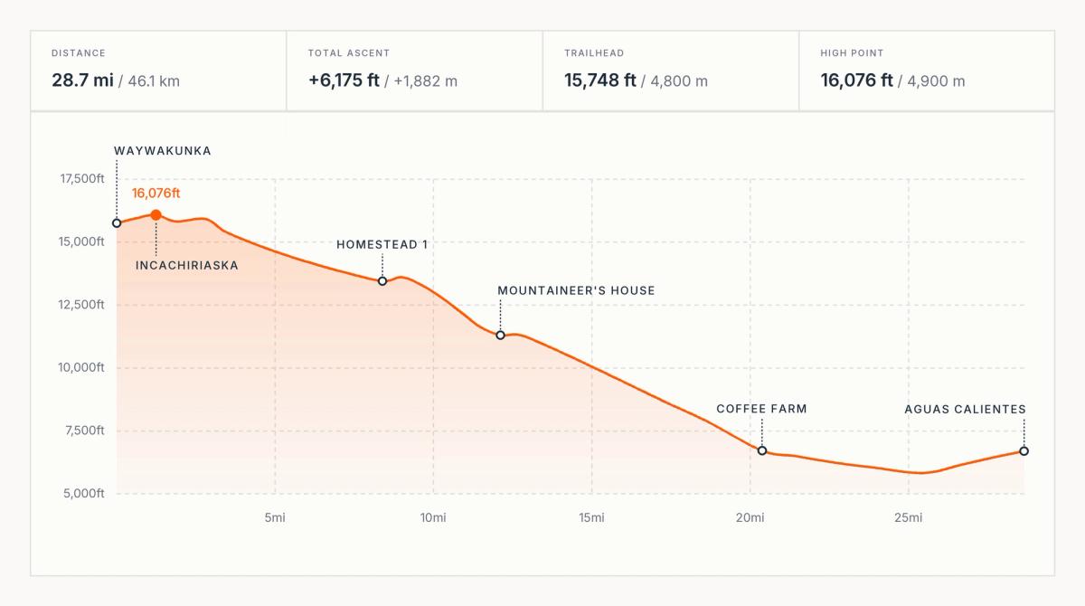
Reading the Elevation Profile
The profile gives you the whole picture. You start at 15,748 feet (4,800 meters), reach 16,076 feet (4,900 meters) about two hours in, and spend the next three days losing elevation. By the time you reach Hidroeléctrica on Day 4, you are at 5,827 feet (1,776 meters), almost 10,250 feet (3,124 meters) below the high point.
The total ascent over five days is only 6,175 feet (1,882 meters), but the total descent is more than twice that. Trekking poles are optional, but I'd bring them if you aren't accustomed to hiking long distances and need extra support for your knees on the way down the Ahobamba valley.
Ahobamba Trek Itinerary: Day by Day
Day 1: Cusco to Waywakunka Pass, Incachiriaska and Palkay Passes
- Distance: 8.4 miles (13.5 kilometers)
- Ascent / descent: 2,625 feet (800 meters) / 4,921 feet (1,500 meters)
- High point: 16,076 feet (4,900 meters)
- Walking time: about 7 hours
- Overnight: campsite at Homestead 1, about 13,450 feet (4,100 meters)
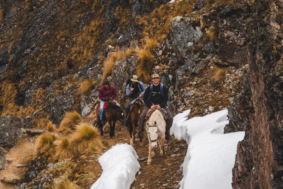
Day 1 is arguably the hardest day of the trek, especially if you don't have a riding horse. We'll pick you up at your hotel in Cusco at 4:00am for the three-and-a-half-hour drive to the Waywakunka trailhead. We eat breakfast on the ride. About an hour and a half into the drive, the pyramid-shaped face of Salkantay appears in the soft morning light. This is when the excitement begins, because soon we'll be trekking directly beneath it. You'll start walking at 15,748 feet (4,800 meters), which is higher than any point on the Inca Trail.
After about two hours of walking, we'll reach Incachiriaska Pass at 16,076 feet (4,900 meters), very close to the southeast ridge of Nevado Salkantay. On a clear morning, this view is one of many reasons to choose this route. We'll take a moment there to catch our breath and our photos. From the pass, we'll descend into a valley toward the base of Palkay Pass. On the descent, you'll want to stop a few times to turn around and admire the broad side of Salkantay. Before we reach the base of the second pass, we'll stop for lunch and a rest. After lunch, we'll hike up and over Palkay Pass.
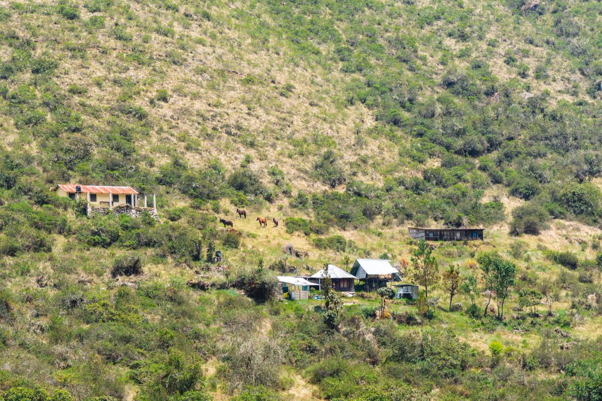
From Palkay Pass, the trail drops directly into the Ahobamba valley, passing the remnants of old mining outposts. Their stone ruins are built in a style similar to Inca walls, and it's easy to mistake them for Inca structures at first glance. After about seven hours of walking, you arrive at Homestead 1, where the cooks and arrieros (horsemen) will have camp set up. Groups who are moving well have the option of pushing on to the Mountaineer's House instead, about another 2.5 hours down the valley. We decide that on the day, on a group-by-group basis.
Day 2: Upper Valley to the Mountaineer's House
- Distance: 3.7 miles (6 kilometers)
- Ascent / descent: 131 feet (40 meters) / 2,297 feet (700 meters)
- Walking time: about 2.5 hours
- Overnight: Mountaineer's House, 11,302 feet (3,445 meters), bed or tent
After the long first day, Day 2 is significantly easier. It's a short walk down the upper valley, past another homestead, to the Mountaineer's House, where you'll arrive before lunch. The Mountaineer's House is rugged luxury. Nate Heald has built it by hand over the past seven years. It has a few beds, a kitchen, and couches made from branches and sticks he gathered in the surrounding forest. It also has a bathroom and a hot shower, a rare thing to find in the middle of a trek. The rest of the day is yours to explore the area.
You have a few options:
- Hike about an hour to the base of the tallest waterfall in the Cusco region, which drops in two long tiers down the valley wall above the cabin.
- Walk 15 minutes across the river to visit Inca ruins.
- Go fishing for trout in the Ahobamba river, or relax and enjoy the valley.
Most people visit the ruins, go fishing, or both, and still have time to rest. This free afternoon is one of the things that sets this trek apart. Most routes to Machu Picchu keep you walking from sunrise to sunset every day, leaving you little time to actually be in the places you're walking through. At the Mountaineer's House, you can also sit and read a book, watch for wild deer, and gaze in awe at a place that looks like it's straight out of The Lord of the Rings.
Day 3: Cloud Forest Descent to the Coffee Farm
- Distance: 8.3 miles (13.3 kilometers)
- Ascent / descent: 1,821 feet (555 meters) / 6,234 feet (1,900 meters)
- Walking time: about 8 hours
- Overnight: guest room at a working coffee farm
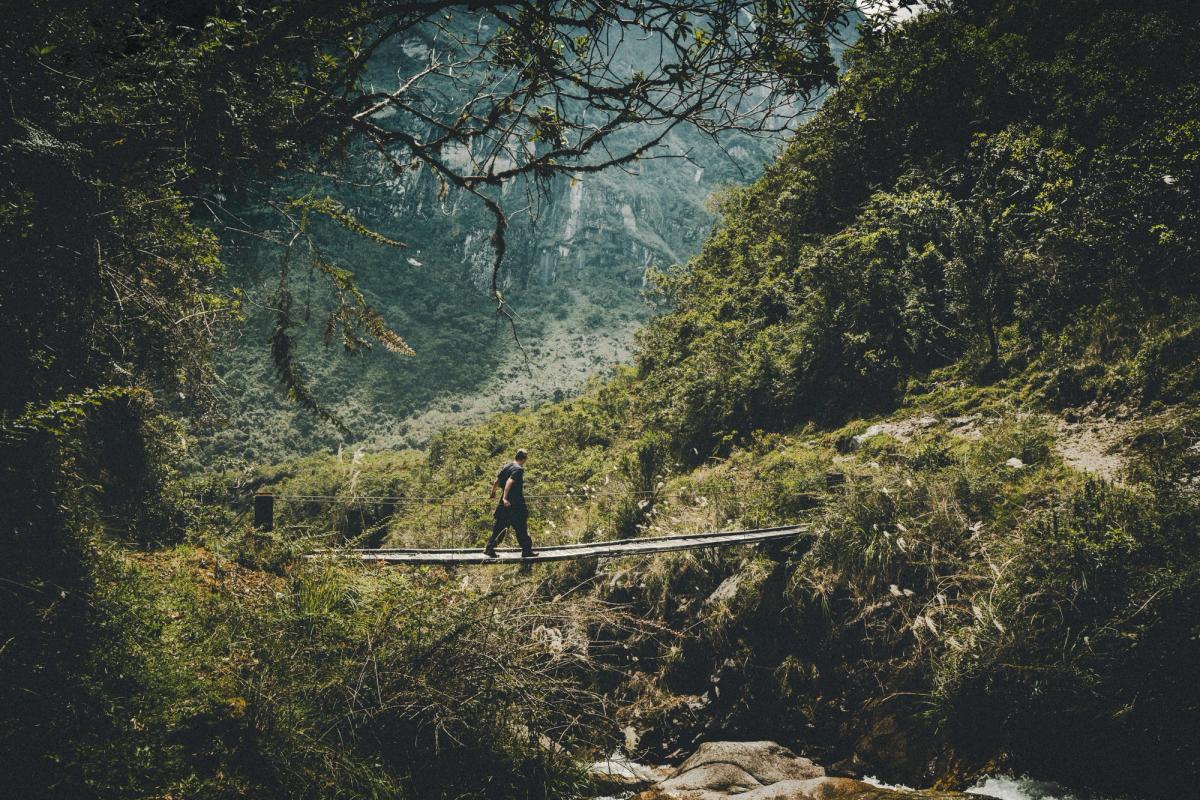
Day 3 is the longest descent of the trek. You lose close to 6,234 feet (1,900 meters) as the valley narrows and the landscape changes from high Andean grassland to bamboo-covered cloud forest. The air gets warmer with every hour, and you'll swap your warm layers for cooler clothing. Sun and insect protection are essential here. All day, you steadily descend into the valley, below you can hear the roar of the Ahobamba river beneath the trail. For most of the descent, you can turn around and still catch views of Nevado Salkantay. In the final hours of hiking, the trail crosses the river three times on bridges. There are a few short ascents, but at much lower altitude than the previous days.
We end the day at the Escobedo family's third-generation coffee farm, where you sleep in a room in the family's guest house. After two nights at altitude, sleeping in a bed in the warm air of the cloud forest feels luxurious. During your stay, we will take you on a tour of their coffee operation and explain the process from start to finish.
Coffee is available to buy and take home.
Day 4: Coffee Farm to Aguas Calientes
- Distance: 8.3 miles (13.3 kilometers)
- Ascent / descent: 1,522 feet (464 meters) / 1,575 feet (480 meters)
- Low point: Hidroeléctrica, 5,827 feet (1,776 meters)
- Walking time: about 4 hours
- Overnight: hotel in Aguas Calientes
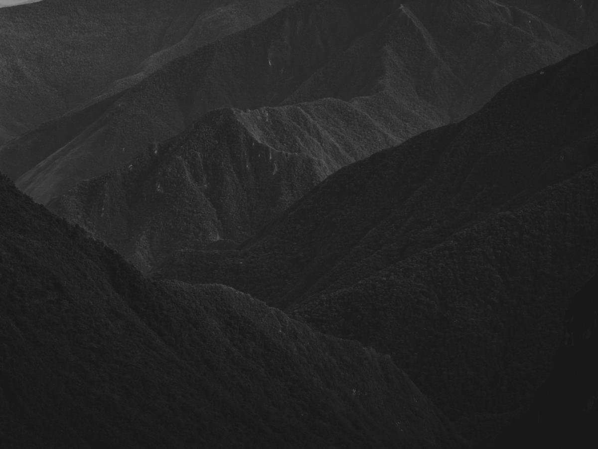
The final descent brings you to the Hidroeléctrica station at 5,827 feet (1,776 meters), the lowest point of the trek. Here you join the standard trail and follow the train tracks into Aguas Calientes. This is also where you'll see other trekkers for the first time, most of them finishing the Salkantay trek. The walk along the tracks is mostly flat and shaded, and it follows the Urubamba River around the base of the mountain that Machu Picchu sits on. It's a very pleasant walk. You'll stay in a hotel this night. Take a hot shower, find a restaurant in town, and rest before your visit to Machu Picchu the next day.
Day 5: Machu Picchu and the Return to Cusco
- High point: about 7,874 feet (2,400 meters)
- Overnight: not included (return to Cusco)
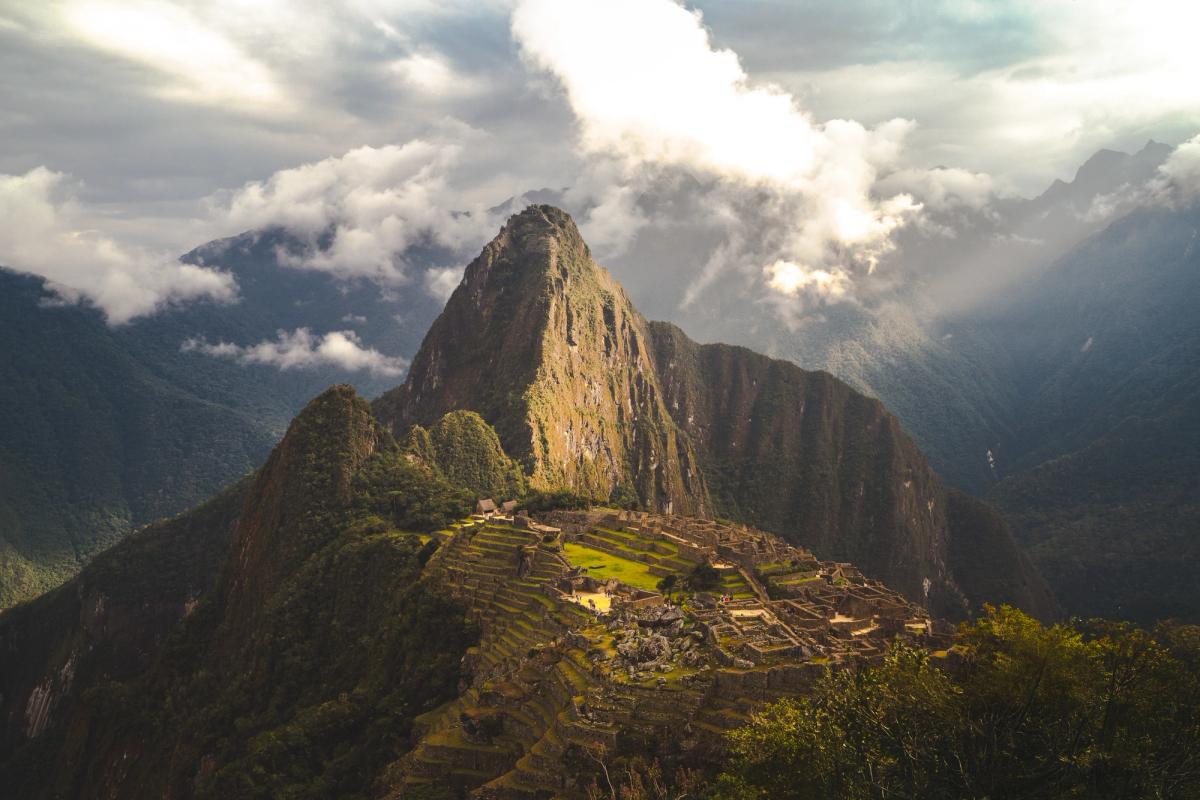
On the final morning, we take the bus from Aguas Calientes up to the sanctuary for a guided visit to Machu Picchu on the circuit you chose when booking. Your entry time depends on the ticket you get. For photos, early morning and late afternoon have the best light. After the visit, you return to Aguas Calientes to collect your bags and board the train back to Cusco, with a transfer to your hotel. Finishing at Machu Picchu after four days alone in the mountains is different from arriving on a day trip. You've walked from the glaciers of Salkantay to the cloud forest that surrounds the citadel, and you understand the landscape the Inca chose for it.
Ahobamba Trek Highlights You Shouldn't Miss
The Tallest Waterfall in the Cusco Region
The waterfall above the Mountaineer's House drops down the valley wall in two long tiers, framed by green and gold hillsides with a snow peak at the head of the valley. It's about an hour's hike from the cabin, and at about 450 feet (135 meters), it's the tallest in the Cusco region. The best time to photograph it is early morning or late evening, when the light is soft.
Inca Ruins Across the River
A 15-minute walk across the river from the Mountaineer's House takes you to the remains of an Inca village. Stone walls line its long corridors, and at its heart stands a ceremonial temple. Inca builders are known for their fitted stonework and for trapezoidal doorways and wall niches, a shape that helped their structures withstand earthquakes. Walking through a village like this one, you get a sense of how the Inca lived in these remote valleys, far from the ceremonial centers like Machu Picchu.
Unlike Machu Picchu, you will have the ruins all to yourself.
A Night at a Third-Generation Coffee Farm
On Day 3, you sleep at a working coffee farm run by the Escobedo family for three generations. Their coffee scores 83+ points on the specialty coffee grading scale, well above the 80-point threshold for specialty coffee, which makes it a brew you must try. You can tour the operation, learn the process from plant to cup, and buy coffee to take home. For many trekkers, this is the night they remember most.
Up-Close Views of Nevado Salkantay
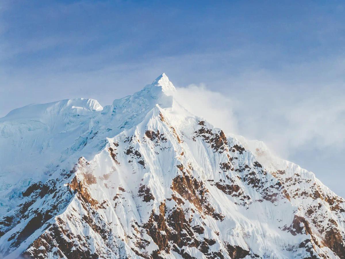
Salkantay, at 20,574 feet (6,271 meters), is the highest mountain in the Cordillera Vilcabamba and one of the most sacred Apus in the Cusco region. On Day 1, Incachiriaska Pass brings you very close to its southeast ridge, and on Day 3 you can still turn around and see it from the cloud forest.
How Hard Is the Ahobamba Trek? Difficulty and Altitude
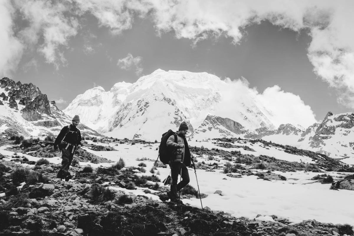
The Ahobamba trek is an intermediate trek. You need a moderate level of fitness and the ability to walk 7 to 8 hours a day on variable terrain. The hardest part is Day 1, which starts at 15,748 feet (4,800 meters) and crosses two high passes. After that, the challenge is mostly on your knees, with more than 15,000 feet (4,580 meters) of descent over four days. If you're unsure about your ability to get over the passes, you can pay an extra fee for a riding horse that will make the day much less daunting.
Fitness Requirements for 7 to 8 Hour Days
You don't need to be an athlete, but you should be comfortable hiking for a full day with a daypack on steep, uneven, and sometimes muddy trails, and then doing it again the next day. If you've completed a multi-day hike in the mountains before, you'll be fine. If you haven't, spend at least a couple of weeks doing day hikes before your trip. Horses and donkeys carry all the heavy gear, so you'll only carry a daypack with water, layers, snacks, and a camera if you choose to bring one.
How to Acclimatize in Cusco
Spend at least three days and two nights in and around Cusco before starting the trek. Cusco sits at 11,152 feet (3,399 meters), and the trek starts nearly 4,600 feet (1,400 meters) higher. Arriving in Cusco and heading straight to the trailhead is the fastest way to ruin your trip. Use those days well: walk around the city, do an easy day hike, drink plenty of water, and avoid alcohol for the first day or two. If your doctor recommends altitude medication, bring it. The CDC's guidance on high-altitude travel is a good place to start.
The first night at Homestead 1 is at about 13,450 feet (4,100 meters). Stronger groups sometimes continue to the Mountaineer's House at 11,302 feet (3,445 meters), which makes for a longer day but an easier night's sleep at lower altitude.
Riding Horses for the High Passes
If you're worried about Day 1, we can arrange riding horses to take you up Incachiriaska and Palkay passes for an extra cost. Riding saves a lot of energy and time for the days that follow. There is also an emergency horse with every group.
Best Time to Do the Ahobamba Trek
The best time to do the Ahobamba trek is May to September, the dry season in the Peruvian Andes. That said, there's no single "best" time. There's only the time that fits what you value most. I wrote more about this in The Best Time of Year for Photography in Peru.
Dry Season (May to September)
From the end of May through August, you'll get the most stable weather, dry trails, and the best chance of clear views of Salkantay from the passes. The night on Day 1 can be chilly, so bring a sleeping bag rated to 14°F (-10°C). The trade-off of the high season is crowds on the other routes to Machu Picchu. On the Ahobamba trek, that's the one thing you don't have to worry about.
Rainy Season (November to April)
From November to April, rain is frequent, especially in the Vilcabamba mountain range. Trails get muddy, and clouds can hide Salkantay on most days. We don't regularly run the Ahobamba trek in these months, but it is possible if that is the only time of year you have available. If you are traveling in the rainy season, prepare for wet days.
What Happens in Bad Weather
Unless we determine the trail is unsafe, we depart rain or shine. If a pass is unsafe or impassable due to heavy snowfall, we can divert to the Salkantay trail. Whichever month you go, it's always a good idea to pack a waterproof rain jacket and a rain cover for your daypack.
Ahobamba Trek Cost: What's Included and What's Not
The Ahobamba trek with AAV starts at USD $985 per person for a group of six or more. That price covers everything from the moment we pick you up in Cusco to the moment the train drops you back off, including Machu Picchu (except for meals in Aguas Calientes).
What the Price Covers
- Transport to the trailhead
- Ahobamba valley permits
- Mountain guide
- Cooks, horses, and arrieros
- All meals during the trek (except in Aguas Calientes)
- Tents and an emergency horse
- One hotel night in Aguas Calientes
- Machu Picchu entrance tickets
- Bus from Aguas Calientes to the Machu Picchu sanctuary
- Guided Machu Picchu visit
- Return train and transfer to Cusco
Why the Price Is What It Is
You'll find Salkantay tours for much less. But even the luxury operators can't offer a private trail experience like we do. Most of them run large-group departures, and the price difference shows up in the group size, the crowds, and the overall experience on the trail. Every Ahobamba departure is private. The cost also includes the Machu Picchu ticket, the bus, the train, and a hotel, which many cheaper tours list as extras.
Ask agencies around Cusco if they can do the Ahobamba trail. I guarantee you'll get one of two responses: they've never heard of it, or, more likely, they aren't allowed in the valley. That's the difference with AAV. We get you access.
Extra Costs to Budget For
- Airport transfers and flights
- Accommodation in Cusco before and after the trek
- Sleeping bag and pad (available to rent in Cusco)
- Riding horse for the high passes on Day 1 (on request)
- Meals in Aguas Calientes
- Travel insurance
- Gratuities for your guide, cooks, and arrieros
- Extra personal snacks
How to Book
Email or text me with your dates, group size, and hiking experience. A 50% deposit in USD secures your booking. You'll also choose your Machu Picchu circuit when you book, so we can reserve your entrance tickets. Read our cancellation policy before booking.
Why Trek Ahobamba With Andes Adventure Visuals
I live in Peru full-time and have spent more than five years exploring the Andes, and this valley is my favorite place in all of Peru, no exaggeration. I first experienced the Ahobamba trek in 2025, when one of the landowners in the valley brought me along to show me the route and its potential.
Here's what that means for your trip:
- Private departures. Your group only, on your dates. Small groups keep the valley as serene as it should be.
- Safety first. I'm a Wilderness First Responder, and every group travels with an emergency horse. We have Starlink satellite internet at the Mountaineer's House and always carry a satellite communication device.
- Community partnerships. We work directly with the families in the valley and the region to operate the trek, including lodging, cooks, horse handlers, and guides.
- Leave No Trace. We aim to leave the trail better than we found it, every departure.
- Honest expectations. We'll tell you exactly what to expect before you book.
- Authentic experience. We don't shield you from our staff. We actively encourage you to interact with them. Even if you don't speak a common language, a smile or a "thank you" goes a long way toward creating genuine connections.
Photographing the Ahobamba Trek
This trek passes through more landscapes in five days than most routes do in two weeks: glaciers, high passes, waterfalls, Inca ruins, cloud forest, and Machu Picchu. Here's what I'd bring.
Wide-Angle Lens
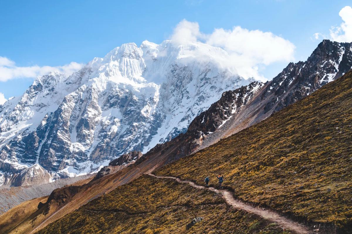
- For Salkantay from Incachiriaska Pass, with trekkers in the foreground for scale
- For astrophotography from the Mountaineer's House on a clear night
Medium Lens
I use this lens 95% of the time on the Ahobamba trail.
- For adventure shots on the trail, the bridges, and the cloud forest
- For life at the homesteads and the coffee farm (always ask before photographing people)
- For Machu Picchu terraces with Huayna Picchu behind
Telephoto Lens
- For compressed shots of Salkantay's dramatic ridges
- For wildlife and detail shots in the cloud forest
- Nice to have, not essential
A note on drones: flying drones is prohibited in the Machu Picchu sanctuary. If you have questions about flying in other locations along the trail, shoot me a text or email.
What to Pack for the Ahobamba Trek
Pack for cold mornings at altitude and warm, humid afternoons in the cloud forest. You'll pass through both on the same trek. The full list is on the trek page; these are the essentials.
Clothing for Cold Passes and Humid Forest
- Wicking base layers (merino wool or synthetic)
- Fleece or light insulating mid-layer
- Insulated jacket, down or synthetic
- Waterproof rain jacket
- Trekking pants
- Warm hat, sun hat, liner gloves, and a buff
- Hiking boots, or trail runners in the dry season, plus camp sandals
Sleeping Gear and Rentals
- Sleeping bag rated to 14°F (-10°C)
- Inflatable or foam sleeping pad
You don't need to own everything. We can arrange rentals in Cusco for sleeping bags, pads, and trekking poles.
Health, Electronics, and Other Essentials
- Passport and cash in Peruvian soles
- Daypack, 30 to 55 liters, with a rain cover
- Headlamp with spare batteries
- 1-liter water bottle (safe drinking water is provided throughout)
- Sunscreen, sunglasses, lip balm, and insect repellent for the cloud forest
- Personal medications and a small first-aid kit
- Power bank and camera
Visiting Machu Picchu at the End of the Trek
Choosing Your Machu Picchu Circuit
Machu Picchu visits follow set circuits, and each one covers a different part of the citadel. You choose yours when you book so we can reserve your entrance tickets, which can sell out in high season. As of 2026, I recommend Circuit 2, the classic circuit, which takes you through the heart of the citadel and includes the iconic postcard view. Tickets are sold only through the official Machu Picchu ticketing site, run by Peru's Ministry of Culture.
Return Train to Cusco
After your visit, you'll take the train from Aguas Calientes back toward Cusco, with a transfer to your hotel. Trains are run by PeruRail and Inca Rail.
What AAV Clients Say
- "I am infinitely grateful ... this trip was beyond anything I could have ever dreamed." — Jake, 29, USA
- "One of the hardest things I have ever done ... and it was all worth it." — Holden, 29, USA
Is the Ahobamba Trek Worth It?
Take it from someone who has been exploring all over Peru for the past 5+ years - yes, it is 100% worth it. However ...
It also depends entirely on who you are.
It is worth it if you want to trek to Machu Picchu without sharing the trail with hundreds of other people.
It is worth it if you want an authentic adventure. In five days you go from 16,076 feet (4,900 meters) beneath a glacier to the cloud forest at 5,827 feet (1,776 meters).
It is not worth it if walking the Inca road through the Sun Gate is the point of your trip. Book the Inca Trail, and book it early.
It is not worth it if you need hot showers and Wi-Fi every night.
Ahobamba Trek FAQ
Is the Ahobamba trek safe?
Yes, with proper acclimatization and moderate fitness. Our guides carry first-aid supplies, every group has an emergency horse, and we make weather decisions based on conditions on the day. We always carry a satellite communication device, and the Mountaineer's House has Starlink satellite internet.
How many days do I need to acclimatize?
About three days in and around Cusco before the trek. The trail starts at 15,748 feet (4,800 meters).
Can I do the trek in the rain?
Yes. We depart rain or shine unless our team determines the trail is unsafe.
Do I need to bring a tent and sleeping bag?
Tents are included. You'll need a sleeping bag rated to 14°F (-10°C) and a sleeping pad, which you can rent in Cusco.
Can I do the Ahobamba trek without a guide?
Contact me if you'd like to do the Ahobamba trek without a guide. There are logistics and fees to coordinate beforehand.
How do I book the Ahobamba trek?
Email or text me with your dates and group size. A 50% deposit in USD secures your booking.
Start Planning Your Ahobamba Trek
The Ahobamba trek can be a standalone trip or part of a larger custom itinerary in Peru. Combine it with a photography workshop in the Sacred Valley, or with a trek in the Chachapoyas region like the Laguna de los Cóndores.
If this is the kind of adventure you're looking for, or if you're not sure it's right for you, send me an email or text me at +51 973 137 403. Tell me your travel dates, group size, and hiking experience, and we'll go from there.