After several hours of hiking in unrelenting rain on the first day, I debated whether withstanding the frigid, wet conditions and shin-deep mud were worth it to reach the Laguna de los Cóndores. Our day began at 6:30am. It lightly drizzled for the first couple hours, and it appeared that the day would be pleasant, walking under cloud-covered skies that protected us from the intense sun. Low clouds engulfed the landscape and created a moody atmosphere for taking photographs of the surrounding farmland. However, after a few hours, the rainfall intensified and didn't relent.
By the time we stopped for lunch at midday I was completely drenched from head to toe, shivering from the wet clothes plastered to my body despite wearing a waterproof poncho. I scarfed down my food and started hiking as soon as possible to get my blood circulating again. It was my fault that I was wet and cold. The trekking operator provided us with insulated, water-repellent pants and a jacket for this type of weather, but I chose not to wear them because I thought I would sweat too much. Twenty minutes after we started moving I warmed up again. The last six hours of hiking felt never-ending because of the rainy conditions. But, despite the wet and cold, and after nearly 11 hours of strenuous hiking we arrived at the basecamp lodge.
Had it not been for the rainy weather, the first day would've been very pleasant. Days 2, 3, and 4 delighted us with completely clear weather. The challenge of Day 1 was more mental than physical. Although I make it sound like the worst day of hiking I've ever experienced, it was 100% worth it and I would do it again knowing just how incredible the Laguna, the archaeological site, and the surrounding virgin cloud forest are.
A Note on the Name "Laguna de los Cóndores"
"Laguna de los Cóndores" translates to Condor Lake, or the Lake of the Condors. This lake is also referred to as the Laguna de las Momias, The Lake of the Mummies, due to the discovery of 219 mummies in mausoleums located on the mountainside above the lake in 1996. There are efforts by individuals outside the local community to permanently change the name to Laguna de las Momias. However, the locals who discovered the lake in the 1950s and current community members take pride in its original name. I will call it Laguna de los Cóndores for the rest of this article in respect for the first people to discover the lake, and I hope you will too.
Discovery of the Laguna de los Cóndores: A Timeline
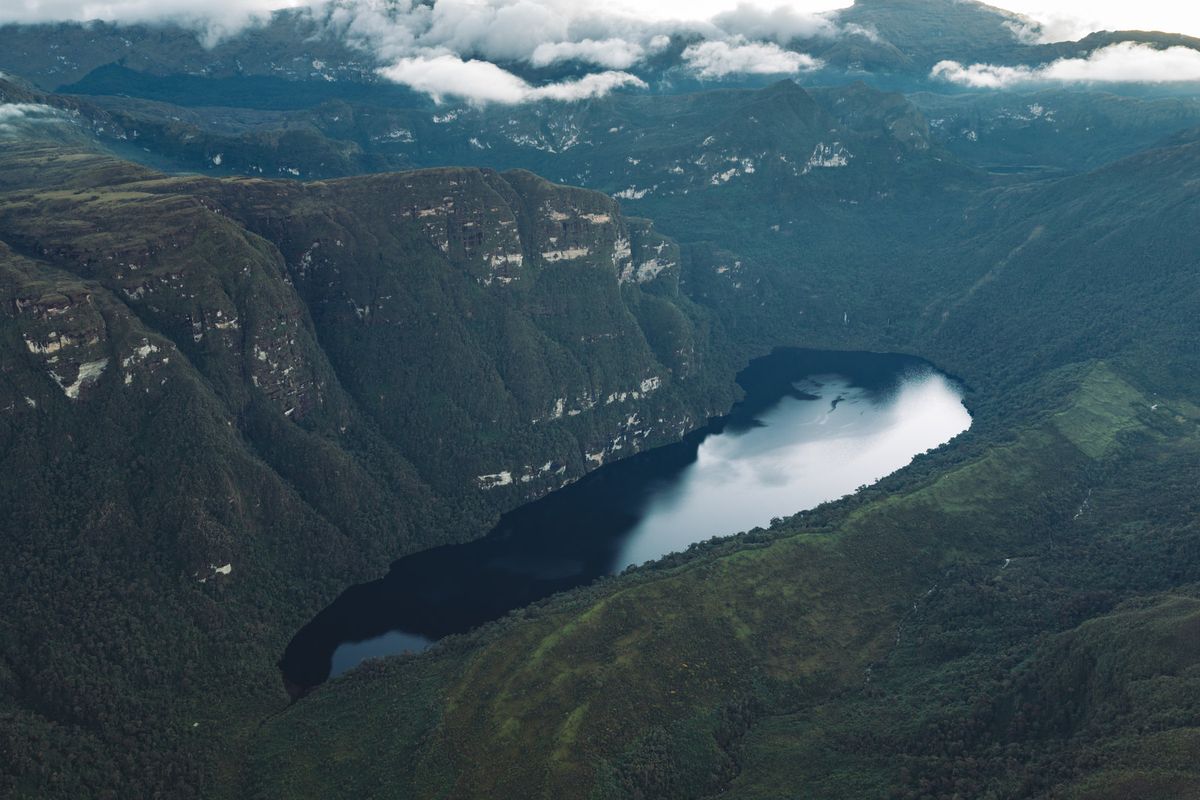
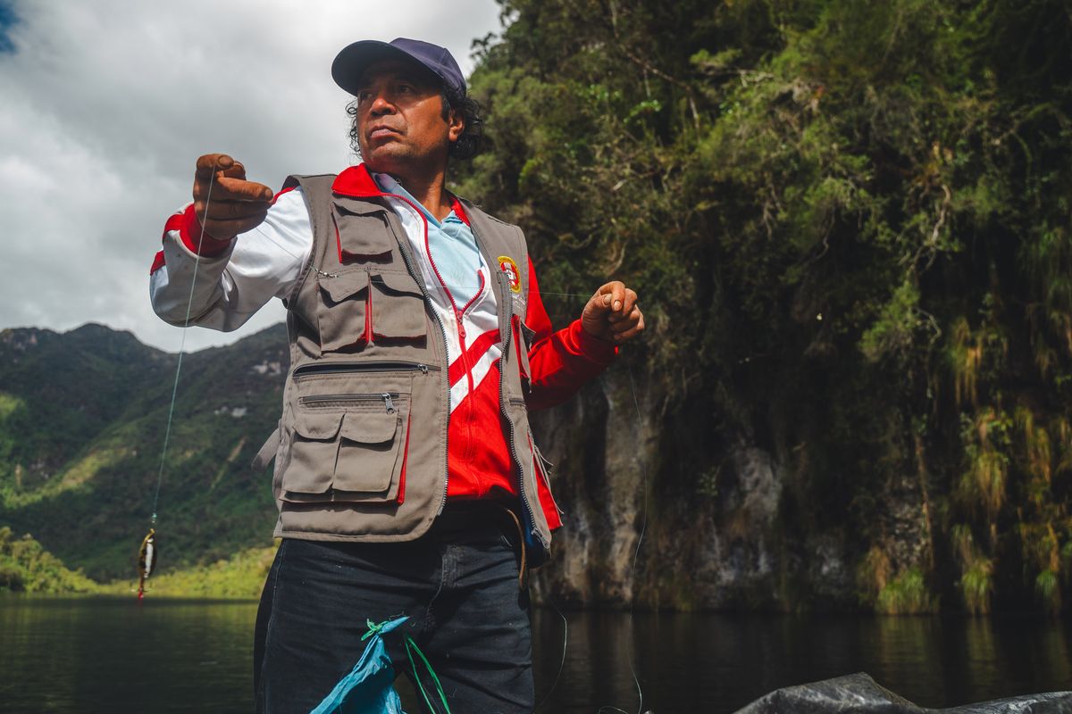
Several decades before the discovery of the tombs where 219 mummies were eventually found, around the 1950s, local campesinos (farmers) from Leymebamba were in search of new lands when they accidentally discovered what is now referred to as the Laguna de los Cóndores, named because the locals who found it observed many Andean condors in the area at the time. A longtime trekking guide and Leymebamba local, Santos Díaz, explained to us that the farmers initially mistook the lake for petroleum due to its deep, black color. They soon realized that it was water and found the fertile lands above the north side of the lake to be ideal for cattle raising. Although they spent decades farming that land, they were unaware of the remarkable Chachapoya archaeological site located only several hundred meters away from them on the far side of the lake. This part of the story isn't told anywhere else online or in scholarly journals and is a crucial fact to the complete story of how the mummies were found. If the local campesinos had not explored these lands, discovered the lake, and established ranching operations, this significant archaeological discovery probably would not have been made in 1996. The community of Leymebamba deserves full credit for rediscovering these lost lands—period.
The 1996 Looting and the 1997 Rescue of 219 Mummies
In 1996, a group of ranch hands working for a cattle rancher named Julio Ullilén discovered tombs situated on a platform in the mountains while they were observing the white cliff bands about 100 meters above the lake's south side. Upon finding mummies, the ranch hands reportedly began hacking at the bodies with machetes in search of valuable items such as gold and silver, which are frequently found in graves from ancient cultures in Peru. Julio himself was not a participant in these crimes and the ranch hands were arrested soon after and most of the items were returned.
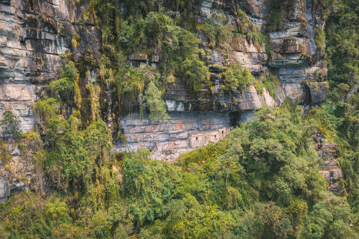
In 1997, a German archaeologist named Peter Lerche was tasked with assessing the damage inflicted on the tombs. He initially estimated that there were approximately 70 mummies contained within the six structures. Regrettably, many of the mummies had been displaced to open areas by tourists and thieves, which led to an emergency operation by the Peruvian government. This operation involved the transportation of 219 mummies and over 2,400 artifacts, carried by horse from the lake to Leymebamba.
In 2012, the Leymebamba campesino community established The Área de Conservación Privada de los Chilchos (The Chilchos Private Conservation Area) in Leymebamba, Chachapoyas — Amazonas. Side note: "Chilchos" is what the Leymebamba locals call the people who lived in the area before them, before modern history and the Incas. The conservation area includes the Laguna de los Cóndores and spans more than 46,000 hectares. It aims to protect the water sources of the Utcubamba River, valuable cloud forest ecosystems that harbor endangered species, and pre-Inca archaeological sites.
Where the Mummies Are Located Now — and What You See at the Lake
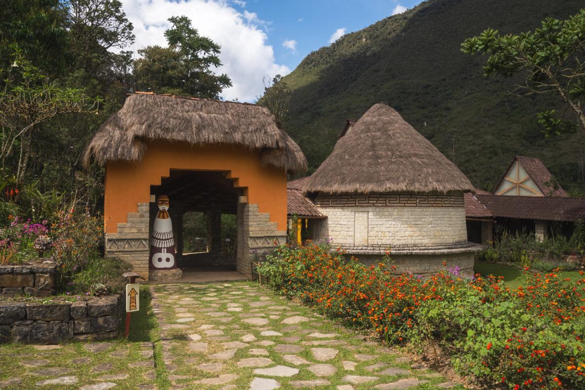
The mummies are not at the lake. All 219 of them, along with more than 2,400 associated artifacts, are in the Museo Leymebamba, in a climate-controlled room you can look into through two large windows. If you make the four-day journey expecting to stand in front of a mummy, you will be disappointed, and it's better to know that before you book than to find out after a full day of strenuous hiking.
I hiked to the lake first and then visited the museum afterward. I would choose this order again because it heightened my anticipation of seeing the incredible collection of mummies and artifacts discovered there. It was like a big reveal after exploring the empty mausoleums. While visiting the site where the mummies were recovered, I could only imagine what once resided there. After hiking another 23 kilometers to return to Leymebamba, I was filled with awe while I observed the bundles of mummies, the textiles, the quipus, and the expressive faces of the well-preserved remains.
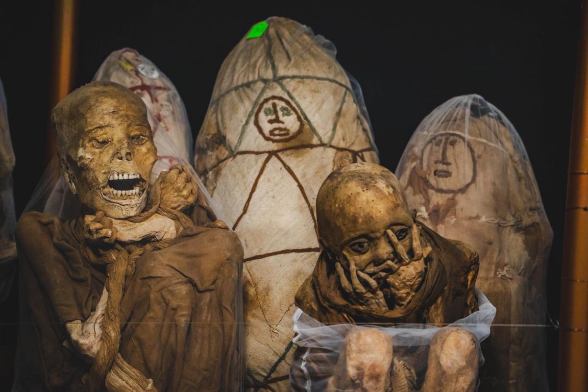
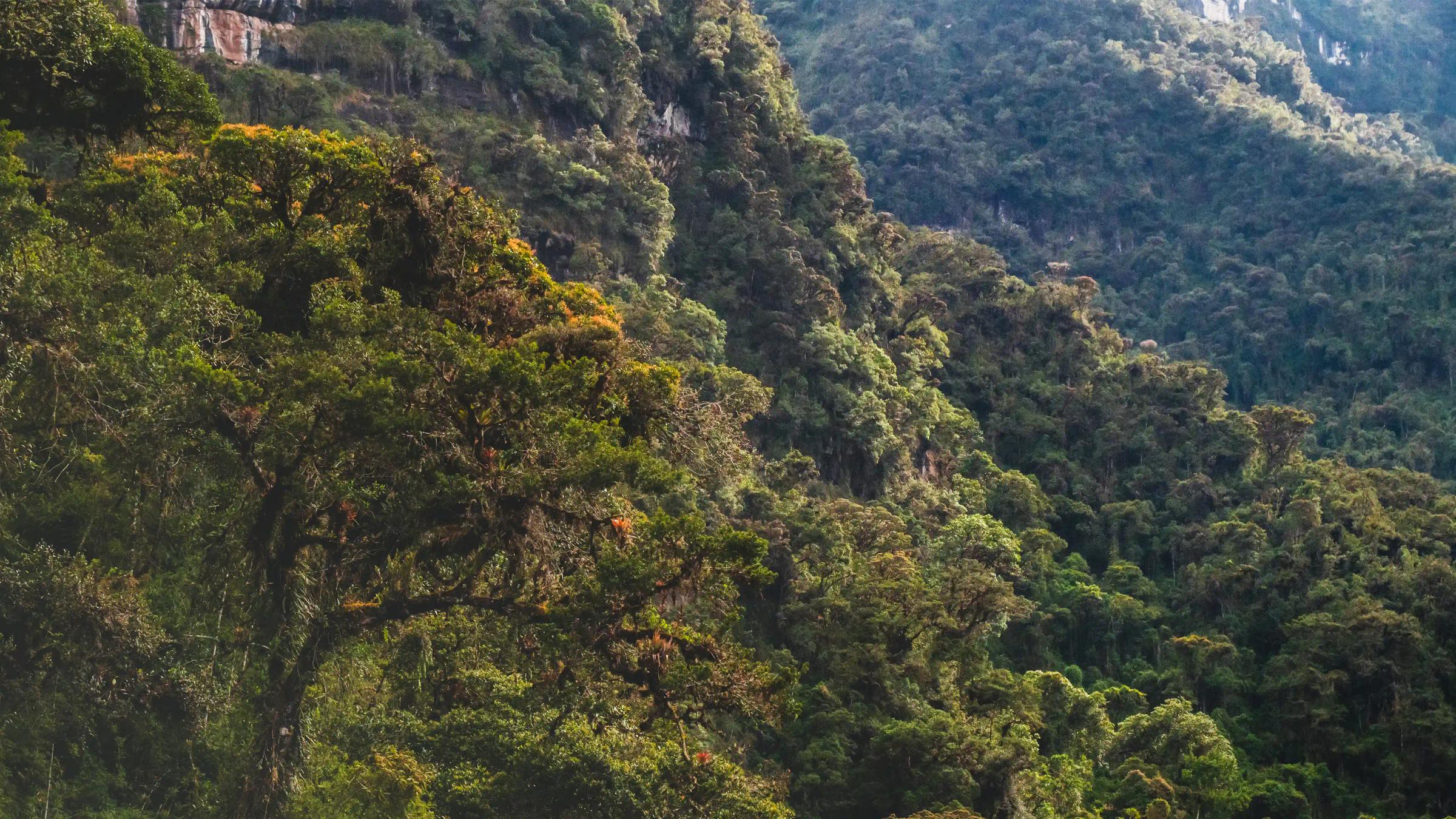
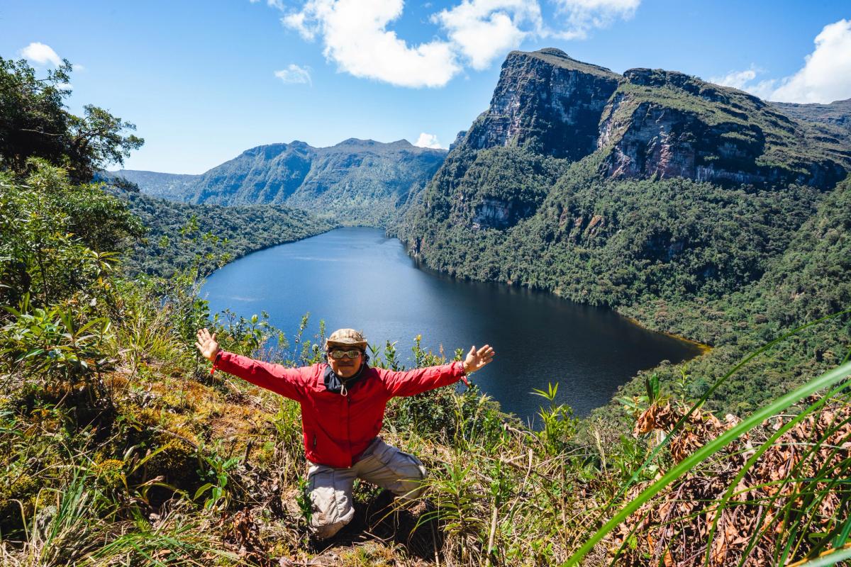
Although the mummies and artifacts have been removed from the archaeological site above the lake, there is still much to see. The lake sits in an extraordinary landscape and remote location, untouched by human development. The lodge is surrounded by a 360-degree expanse of virgin cloud forest, featuring vibrant flora, towering palm trees, and expansive views into areas that no modern human has ever explored. As you approach Quindecocha, the lake that feeds the Laguna de los Cóndores, a massive landslide opens up to reveal a stunning panoramic view of the lake and the mountain rising prominently above it. Further along this trail, additional mausoleums are visible to the naked eye; however, the local community does not permit people to enter them.
The day you visit the site where the mummies were discovered, you'll experience the serenity of the high jungle. At 2,800 meters, it is incredible that such a tropical place exists at high altitudes. As the guides paddle out to the middle of the lake, you are surrounded by vertical cliff walls draped in lush vegetation and hillsides filled with dense forestation. It is a place unlike any other in the world. The journey to the other side of the lake takes about 30 minutes. Once you arrive, the final trail to the archaeological site begins. After roughly 45 minutes of scaling wooden ladders and navigating muddy paths, you'll stand below the roof of the archaeological site. At the site, you'll notice that four of the six structures still display white, red, and yellow pigments. Two of these structures feature the distinctive zigzag friezes characteristic of Chachapoya funerary architecture. There are also drawings depicting serpents, condors, and various animal and human-like shapes. Among the remnants are a few human skulls, wood carvings, and small pieces of textiles.
How to Get to Leymebamba and to the Laguna de los Cóndores
To get to Leymebamba, you must first get to Chachapoyas — the capital of the Amazonas region of Peru.
From Lima to Chachapoyas
- Take a 24-hour nonstop bus with transportation company CIVA.
- Take a 1.5-hour flight from Lima's Jorge Chávez International Airport to Chachapoyas Airport. The flight is only operated by ATSA Airlines with one flight per day. Take a 10-minute taxi ride from the Chachapoyas airport to your hotel.
From Huaraz to Chachapoyas
- Take a 10-hour bus to Chiclayo with Movil Bus or Allinbus transportation companies. From Chiclayo you then take a 12-hour bus to Chachapoyas with the CIVA transportation company.
- Take a 5-hour bus to Chimbote. Then take a 17-hour bus ride to Chachapoyas.
From Chiclayo to Chachapoyas
- 12-hour bus to Chachapoyas with CIVA.
From Chachapoyas to Leymebamba
- Take a 2.5-hour car ride to Leymebamba. You can take public transport from the municipal transport station for 20 to 25 soles. If you are with an AAV expedition, we will travel from Chachapoyas to Leymebamba in private transport.
The Trek to the Lodge: Distance, Elevation, and Time
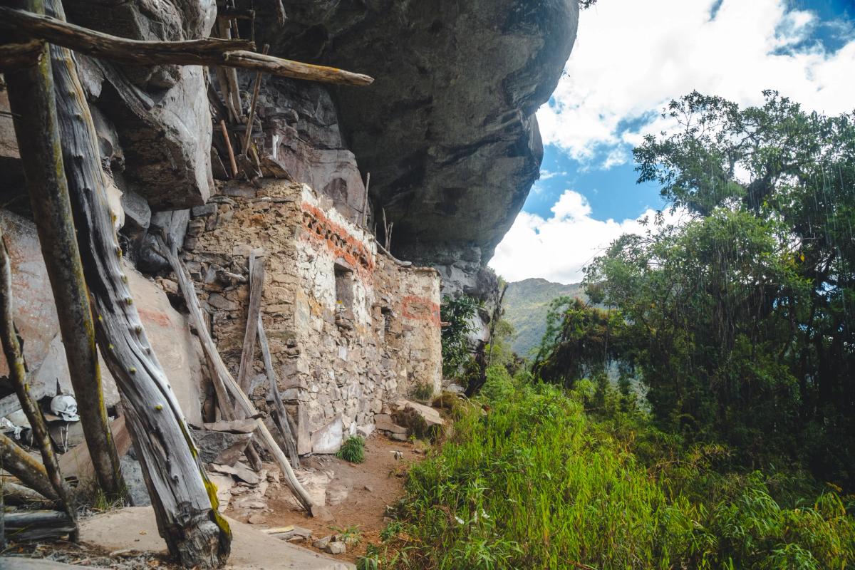
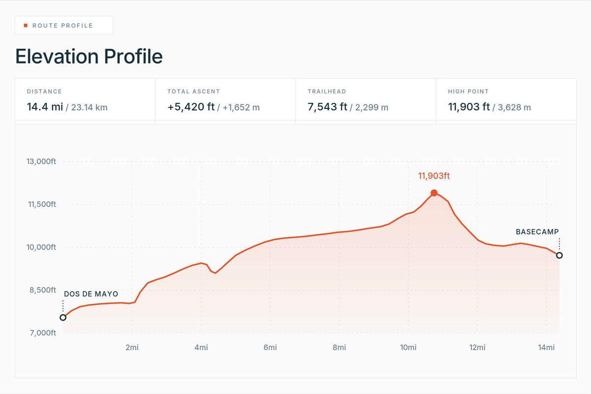
From Dos de Mayo, the village located directly above Leymebamba, you will commence your trek to a privately owned rustic lodge equipped with bunk beds, foam mattress pads, and bathrooms. The one-way distance to the lodge is approximately 14.5 miles (23 kilometers). Walking will take about 9 to 11 hours. Under ideal conditions, horseback riding can reduce the travel time to about 8 hours. The total elevation gain is over 5,250 feet (1,600 meters), reaching a maximum elevation of 11,903 feet (3,628 meters) at approximately two-thirds of the way along the trail. For groups looking for a less strenuous option, a camping site is available about halfway at mile 8.6 (kilometer 13.8), at an altitude of 11,154 feet (3,400 meters), before you ascend to the high pass and then descend to the lodge.
Horseback vs. Hiking
Unless you are in exceptional physical condition and have extensive experience on other challenging trekking trails, I recommend you ride a horse from the trailhead to the basecamp lodge. At AAV, we require groups that don't meet the requirements for walking to take riding horses, due to safety and time constraints. This is not about pride; this trail is CHALLENGING and poses a challenge even for the most experienced trekkers. By opting for a horse, you save energy for the day hikes that begin at the lodge, which require you to travel on foot. Riding a horse is by no means easy. Over long hours your legs, buttocks, and hands will tire, and there are several sections of the trail that require you to dismount and walk for safety reasons.
Trail Conditions
Trail conditions can change from day to day and season to season. Regardless of the time of year you choose to visit, you should expect to encounter deep mud — especially in the final three hours of the approach. During the high season, a few days of direct sunlight can harden many sections of the trail, making walking slightly easier. I advise that you mentally prepare for the most challenging conditions and be pleasantly surprised if they are easier than expected.
Accommodation at the Lake
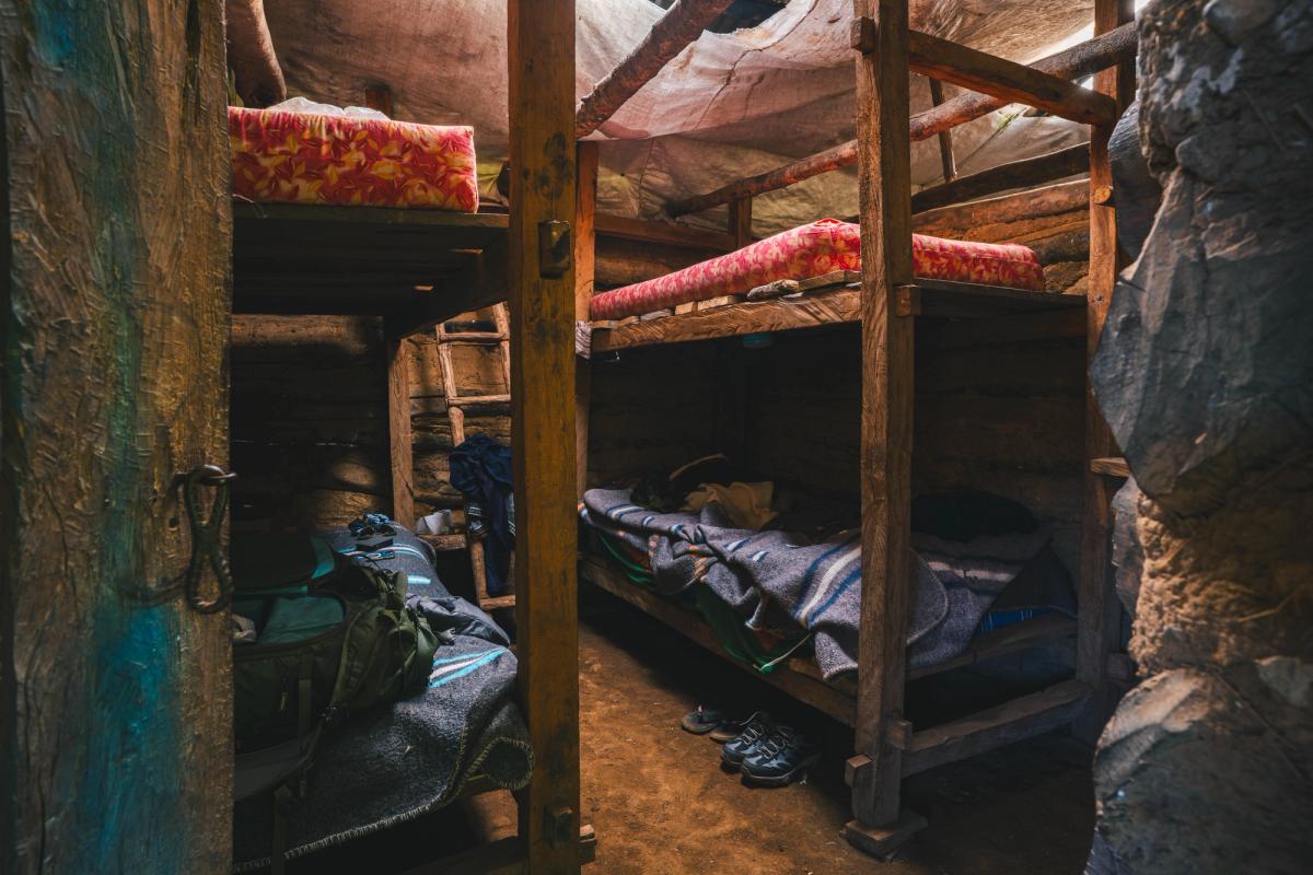
As mentioned earlier, the basecamp lodge is equipped with bunk beds to accommodate approximately 20 individuals, foam mattress pads with comfortable bedding, and two bathrooms with sinks and toilets. There are two dining areas, clotheslines for drying your wet clothes, and running water. There is no cell service or internet connection, and no shower — you can rinse off with running water from a spout.
Day Hikes from the Lodge
There are two separate day hikes from the basecamp lodge: the hike to Quindecocha, a lake situated above the Laguna de los Cóndores, and the shorter trip to the mausoleums, which begins with a 30-minute paddle across the lake before the trail up to the site. Both are significantly less demanding than the 23-kilometer trek to the basecamp and are generally in better condition. However, they can still be muddy and require your focus and a moderate level of fitness.
Best Time to Visit the Laguna de los Cóndores
In mid-August, I encountered one full day of rainy weather and three days of completely dry weather, with one of those days completely clear from sunrise to sunset. This is typical weather from May until October, with peak months from June through August. Although these are the driest months, a number of people take on this trek during the rainy months from December to March. One advantage for photographers going during the off-season is that you see everything with a very moody atmosphere: the lake, the forests, and the ruins.
What Is Included in the Cost of the Laguna de los Cóndores Trek?
You don't do this trek independently without the support of a trekking operator. The trail goes through community land, and the Leymebamba campesinos who run the conservation area require that visitors travel with a local guide. Arrieros manage the horses that carry your gear and the horses that you ride. The cost you pay covers the guide, cook, the arriero and horses, the lodge, the boat across the lake, and the conservation area fee, and the food. AAV expeditions include all of the above, plus private transport from Chachapoyas.
Difficulty, Reviews, and Registry Data
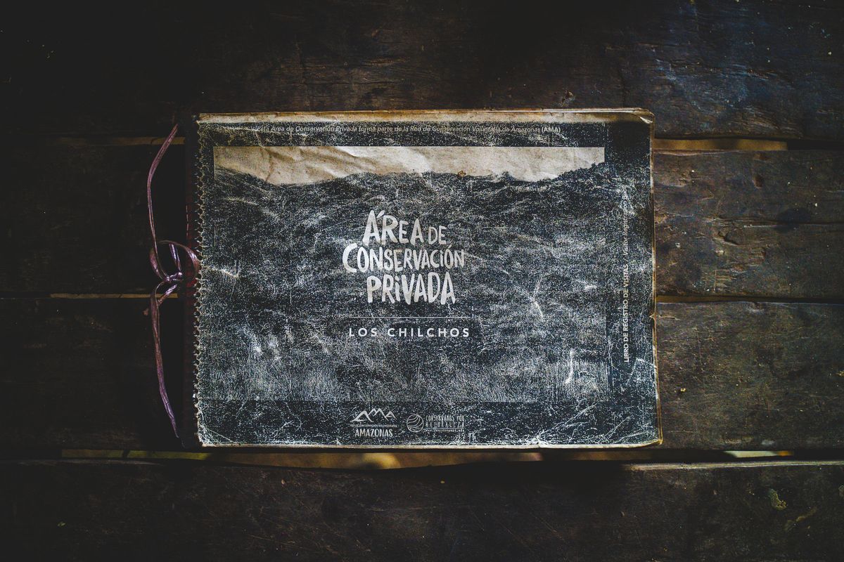
This is undoubtedly a strenuous trek and is not for everyone. You should be mentally and physically prepared for the long days in and out of the lake. You should also be well prepared with extra pairs of dry clothes that you can change into. If you complete the trek in five days, the first two days will be easier because the hike to the lodge is divided into two parts. Above all, have an open mind. Trust that every ounce of energy that you spend getting there is worth it. If you don't believe me, here are a few quotes from the registry book that I found at the lodge:
- "A magnificent and magical trip. I loved the nature and I would love to return." — Mio, 46 USA
- "It is my third time coming here, and it does not cease to impress me." — Sindy, 20 Peru
- "A very beautiful place. The trail is worth the pain. [The] trout from the lake was very tasty." — Edward, 24 USA
- "I found everything here that I was looking for: Pure nature, first class archeology, delicious food, and trekking. Spectacular!" — Mirtha, 38 Peru
- "A stunning area that is totally unspoiled." — Ollie, 22 England
I calculated that the average age of visitors to the Laguna de los Cóndores is 35 years. The oldest visitor was 73 years old, while the youngest was 8 years old. Most of this data was collected between 2017 and 2019, with a few dozen entries recorded from 2020 to 2026. The sample size consisted of 234 visitors registered in the log book.
Photographing Laguna de los Cóndores: Equipment to Bring
On completely clear days, I observed that sunrise offers better light because the mountains and hills below the lake to the east are lower in elevation, meaning the light is still soft when it starts to shine directly on the mountain. Midday and afternoon cloud cover offer a moodier atmosphere around the lake and surrounding forest. No matter the conditions, there is something to capture every day if you're creative.
Wide Angle Lens
I shot on a prime 20mm.
- For shots while on the boat, paddling on the lake
- For shots that capture wider scenes of the tall cliff walls and surrounding forest
- For shots hiking through the forests on Days 2 and 3
- For shots at the ruins. Capture someone in the frame with the structures and the surrounding forest
- Astrophotography with the lodge as a foreground element and stars against the forest
Medium Lens
I shot on a 28-75mm. This was most-used lens of the trip.
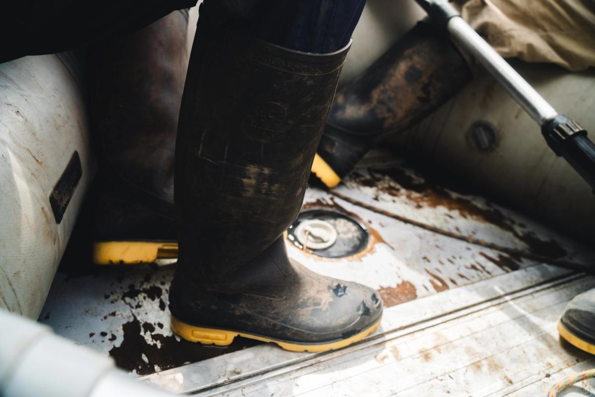
- For shots of the approach. Capture farmland, adventure-style shots while hiking, detail shots of boots walking through the mud, and compressed shots of the lake with the surrounding forest while on the boat
- For shots at the ruins to capture the size of the site. Place someone in the shot and compress the scene to show the size of the mausoleums
Telephoto Lens
I shot on a 70-200mm.
- Best for detail shots of the surrounding forest
- Not an essential lens, but nice to have if you already own one and have the space for it in your luggage
Drone
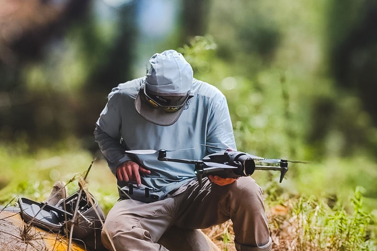
I shot on a DJI Mavic 4 Pro.
- For shooting a wide range of scenes if you have one and know what you're doing with it
- For shooting full shots of the lake and the surrounding virgin forest
- Bring it only if you've completed at least 50 flights with your drone
- Do NOT bring a drone if you are beginner pilots
- Not an essential tool, but opens up a lot of options
- Must be extremely careful to not disturb the wildlife
- Must adhere to Peruvian remote pilot laws
- We are not responsible for your drone flying
Is the Laguna de los Cóndores Worth It?
It depends entirely on who you are.
It is worth it if you are self-sufficient. It is not necessary to be the fastest or strongest in the world, but you should be able to manage your own body, your personal gear, and your own wet-weather problems for four days without anyone holding your hand. Come prepared and ask questions before your departure if you are unsure about what to bring.
It is worth it if remoteness and off-the-beaten-path adventures matter to you. Only about 150 to 200 people visit the lake each year. To put that in perspective—400 people start the Inca Trail PER DAY. You are likely to be the only group on the trail and at the lodge.
It is worth it if you want to photograph a place that has seldom been photographed well.
It is not worth it if you are only coming for the mummies. They are in Leymebamba, and you can easily see them for the price of a taxi and the entrance fee to the museum.
It is not worth it if you expect guaranteed conditions. The weather can be unpredictable in the region and you have to take what you get. May to September offer drier weather, but it's still possible to experience a rainy day or two.
It is not worth it if you have only a couple of free days in the region. If Chachapoyas is a quick pit stop rather than your destination, you should take day tours to the typical tourist spots. They are nice places to visit in their own right and much more accessible to people who prefer standard itineraries.
For me, it was undoubtedly worth it.
I first learned about the Laguna de los Cóndores while scrolling around on Google Earth. I saw photographs of the mummies and read about this mysterious lake that required a long day of rugged hiking to reach. It's been in my mind for three years, and when I finally had the opportunity to become acquainted with and know this place, it was a dream come true. Not sure if this trek is for you? Send me an email or text, and we can discuss it further.
Other Places to Explore from Chachapoyas
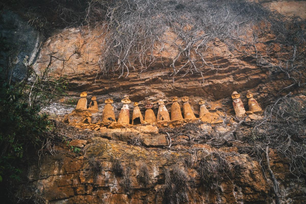
While in Chachapoyas, I had the opportunity to explore other hidden gems, including a secret trail in Gocta that offers the best perspectives for photography, sarcophagi that surpass the popular Karajía at Cerro el Tigre/San Jerónimo, the Chachapoya culture fortress of Kuélap, and other stunning waterfalls that will leave you in awe. I plan to write blogs about these places in the future and will update this blog with links when I do.
The Laguna de los Cóndores can serve as either a standalone adventure or an integral part of a larger custom circuit designed by AAV for you.
If this is the kind of adventurous experience you're looking for in Peru or you have any questions, send me an email. I'm eager to help create memorable experiences for anyone looking to explore marvelous parts of Peru other than Cusco/Machu Picchu.